Xinjiang Autumn Travel: An Epic G331 Road Trip Beneath the Altai Mountains
An Epic G331 Road Trip Beneath the Altai MountainsAutumn is one of the most rewarding seasons for a road trip through northern Xinjiang. As the forests around the Altai Mountains change from green to
Autumn is one of the most rewarding seasons for a road trip through northern Xinjiang. As the forests around the Altai Mountains change from green to gold, rivers reflect the colors of the valleys and grasslands turn into warm shades of yellow, the landscape becomes one of the most photogenic parts of China.

One of the most interesting ways to experience this scenery is a road trip along G331 National Highway, particularly through the Xinjiang section connecting Qinghe, Fuyun, Altay and the surrounding northern Xinjiang landscapes.
For travelers searching for Xinjiang autumn travel, G331 road trip, Altay autumn scenery or northern Xinjiang road trips, this route combines mountain lakes, grasslands, birch forests, river valleys, wetlands and golden poplar forests in one long journey.
The official Xinjiang transport planning documents identify G331 as the Dandong–Altay national highway and list Qinghe, Fuyun and Altay among its important nodes in Xinjiang. Local tourism authorities have also promoted the Qinghe–Fuyun–Altay section as part of an extended self-driving tourism corridor.
The appeal of an autumn road trip is not limited to one famous attraction. The real experience comes from watching the scenery change gradually as you drive.
Near the eastern part of the Altay route, highland lakes and grasslands provide wide-open views. Further west, the landscape becomes more dramatic, with mountain valleys, birch forests and the Irtysh River. Farther along the route, wetlands and poplar forests add another layer of autumn color.

This variety makes the G331 journey different from a conventional sightseeing itinerary. The road itself becomes part of the attraction.
According to Xinjiang's official autumn travel information, northern Xinjiang generally reaches its strongest autumn color around late September and early October, although the exact timing varies with location and weather. The peak period can be relatively short, so flexible planning is important.
| Route Section | Main Landscape | Recommended Experiences |
|---|---|---|
| Qinghe | Highland lakes, grasslands and archaeological landscapes | Landscape photography and cultural exploration |
| Fuyun | Mountain valleys, birch forests, rivers and geological formations | Hiking, photography and scenic drives |
| Irtysh River Valley | River bends, grasslands and golden vegetation | Scenic driving and autumn photography |
| Burqin and Habahe Area | River valleys, wetlands and golden poplar forests | Nature photography and sunset views |
| Altay Area | Mountain landscapes and northern Xinjiang scenery | Road trips and extended exploration |
For travelers approaching the Altay Mountains from the east, Qinghe County provides an atmospheric introduction to the Xinjiang section of G331.
The Sanhaizi area is known for its highland lakes, grasslands and archaeological remains. During autumn, golden grassland and surrounding mountain scenery create a strong contrast with the darker tones of the landscape.

The area is also associated with stone burial structures and deer stones, which add a cultural dimension to the journey. These remains are especially interesting for travelers who want to combine natural scenery with the history of the Eurasian steppe.
What to See Around Qinghe
| Attraction | Why Visit |
|---|---|
| Sanhaizi | Highland lakes, grasslands and wide-open autumn landscapes |
| Stone Burial Sites | Ancient archaeological landscapes connected with the steppe |
| Deer Stones | Distinctive historical monuments associated with the region |
If your main goal is autumn photography, allow extra time here rather than treating Qinghe as simply a transit point.
As the road continues westward, Fuyun County becomes one of the major highlights of the journey.
Koktokay is one of the best-known natural attractions in the area. The official regional tourism authority lists Koktokay as a national 5A scenic area, with landscapes including the Irtysh Grand Canyon, Kokosuli Lake, geological formations and river scenery.

Autumn is particularly attractive because the landscape combines colorful vegetation with exposed rock formations and the Irtysh River. Birch trees and conifers appear among the mountains, while the river creates a contrasting blue-green line through the valley.
Irtysh Grand Canyon
The Irtysh Grand Canyon is one of the major scenic areas around Koktokay. Its combination of granite formations, forests and the Irtysh River creates a landscape that changes dramatically with the weather and time of day.
Official geological information describes distinctive granite peaks in the area, together with forests and the Irtysh River. Several recognizable formations have become important landscape features of the region.
Kokosuli Lake
Kokosuli Lake adds a quieter dimension to the Koktokay landscape. Instead of focusing entirely on steep mountain scenery, travelers can experience wetlands, open water and surrounding vegetation.
It is a useful stop for photographers who want more variety in their autumn images.
Koktokay No. 3 Mine
The No. 3 Mine is another notable attraction in the Koktokay area. Unlike the surrounding natural landscapes, it provides insight into the region's mining history and geological resources.
Including the mine in your itinerary can make the trip more balanced, especially if you are interested in geology, industrial history or the connection between natural resources and local development.
After exploring Fuyun and Koktokay, the journey can continue toward the western part of the Altay region.
The Irtysh River is an important geographical feature of this journey. Instead of seeing the landscape as a series of isolated attractions, following the river helps you understand how the valleys, forests, grasslands and settlements connect with one another.

In autumn, vegetation along the river can turn golden, creating long stretches of colorful scenery between mountain sections and open valleys.
Golden Poplar Forests Along the River Valleys
Poplar forests are one of the most recognizable autumn landscapes in northern Xinjiang.
When the leaves turn yellow, the trees contrast strongly with the darker mountains, river water and open grassland. The best photographs often come from places where several landscape elements appear in the same frame rather than from photographing the trees alone.
For photographers, look for combinations of golden trees, river bends, distant mountains and open sky.
Further west, Habahe offers another type of autumn scenery.
The Akeqi National Wetland Park is a useful stop for travelers who want a slower and quieter experience after spending several days on the road.
Autumn reeds can take on pale golden tones, while water surfaces reflect the surrounding vegetation. Around sunset, birds moving across the wetlands can create particularly peaceful scenes.
Why Visit Akeqi National Wetland Park
The wetland environment provides a contrast to the mountains and forests earlier in the journey. Instead of dramatic peaks, the attraction here is the combination of water, reeds, open sky and wildlife.
For travelers who enjoy landscape photography, birdwatching or quiet walks, this can be a worthwhile addition to a G331 autumn itinerary.
Long-distance road trips often create their own landmarks, and G331 is no exception.
The 8,888 Kilometer Road Sign
The 8,888 kilometer marker has become a popular photo stop for road-trip enthusiasts. The large number makes it easy to recognize in photographs and represents the scale of the G331 journey.

If you are traveling specifically for the road-trip experience, this is more than a simple roadside photograph. It becomes a visual record of how far you have traveled along one of China's major northern routes.
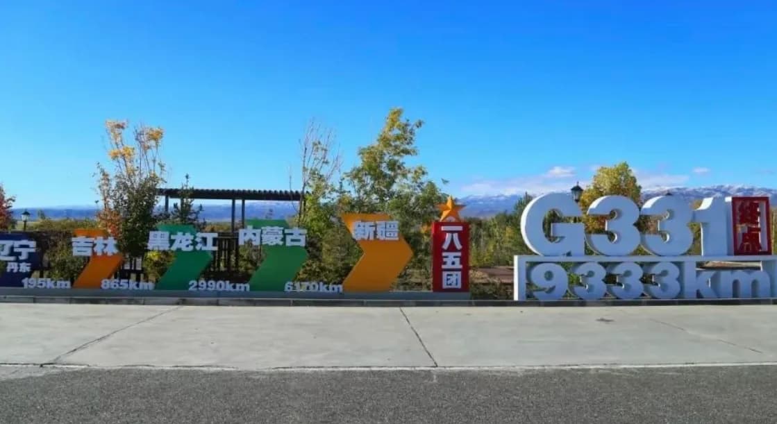
The 9,333 Kilometer G331 Terminal Marker
The terminal mileage marker associated with the G331 route is another popular road-trip landmark in the Altay area.
For travelers following the highway toward its western end, reaching the terminal marker can provide a natural conclusion to the journey.
Before planning your route around a specific mileage marker, confirm its current roadside location and accessibility because road layouts and traffic arrangements can change.
There is no single date when the entire northern Xinjiang route reaches peak autumn color.
The timing changes according to elevation, latitude, local weather and vegetation. Higher or colder areas can change color earlier, while lower river valleys may remain green for longer.
| Period | Typical Conditions | Travel Considerations |
|---|---|---|
| Early September | Some higher areas begin changing color | Useful for travelers who prefer fewer crowds and mixed summer-autumn scenery |
| Mid to Late September | More noticeable autumn colors across parts of northern Xinjiang | Good period for flexible autumn road trips |
| Late September to Early October | Often the strongest autumn-color period in northern Xinjiang | Popular travel period; accommodation and transport demand can increase |
| Mid October | Many mountain areas become colder and some foliage begins to fall | Check weather and road conditions carefully |
Because autumn color changes quickly, it is better to check local weather, recent travel reports and scenic-area conditions shortly before departure rather than relying only on a fixed calendar date.
The answer depends on whether your priority is simply reaching the major attractions or enjoying the road itself.
A short itinerary can focus on Qinghe and Fuyun, while a longer journey allows time for the Irtysh River Valley, Habahe and additional photography stops.
| Trip Style | Suggested Approach |
|---|---|
| Short road trip | Focus on Qinghe and Koktokay |
| Balanced itinerary | Qinghe, Koktokay, Irtysh River Valley and Habahe |
| Photography-focused trip | Allow additional days for weather, sunrise, sunset and unexpected roadside stops |
| Long northern Xinjiang road trip | Combine the G331 corridor with other Altay destinations |
Do not underestimate driving time. Northern Xinjiang is geographically large, and a route that looks short on a map can take much longer when you include scenic stops, road conditions, weather and photography.
Most of the main highway journey can be approached with a normal passenger vehicle under suitable road and weather conditions.
However, some attractions are reached through secondary or mountain roads. If you plan to visit places such as Sanhaizi and other remote scenic areas, a vehicle with higher ground clearance can provide additional flexibility.
Always check the latest road conditions before leaving the main highway. A road that is suitable for a passenger car in dry weather may become considerably more difficult after rain, snow or freezing conditions.
One of the most important rules for a northern Xinjiang road trip is simple: do not wait until the fuel gauge is nearly empty.
Fuel stations and basic supplies are available in county towns and major settlements along the route, but remote scenic areas can be much less convenient.
A practical strategy is to refuel whenever you enter a major town, especially before heading into mountain or remote scenic areas.
| Preparation | Recommended Practice |
|---|---|
| Fuel | Refuel in major towns before entering remote areas |
| Drinking water | Carry enough for long driving sections |
| Food | Keep basic snacks for unexpected delays |
| Power | Carry a car charger and backup battery |
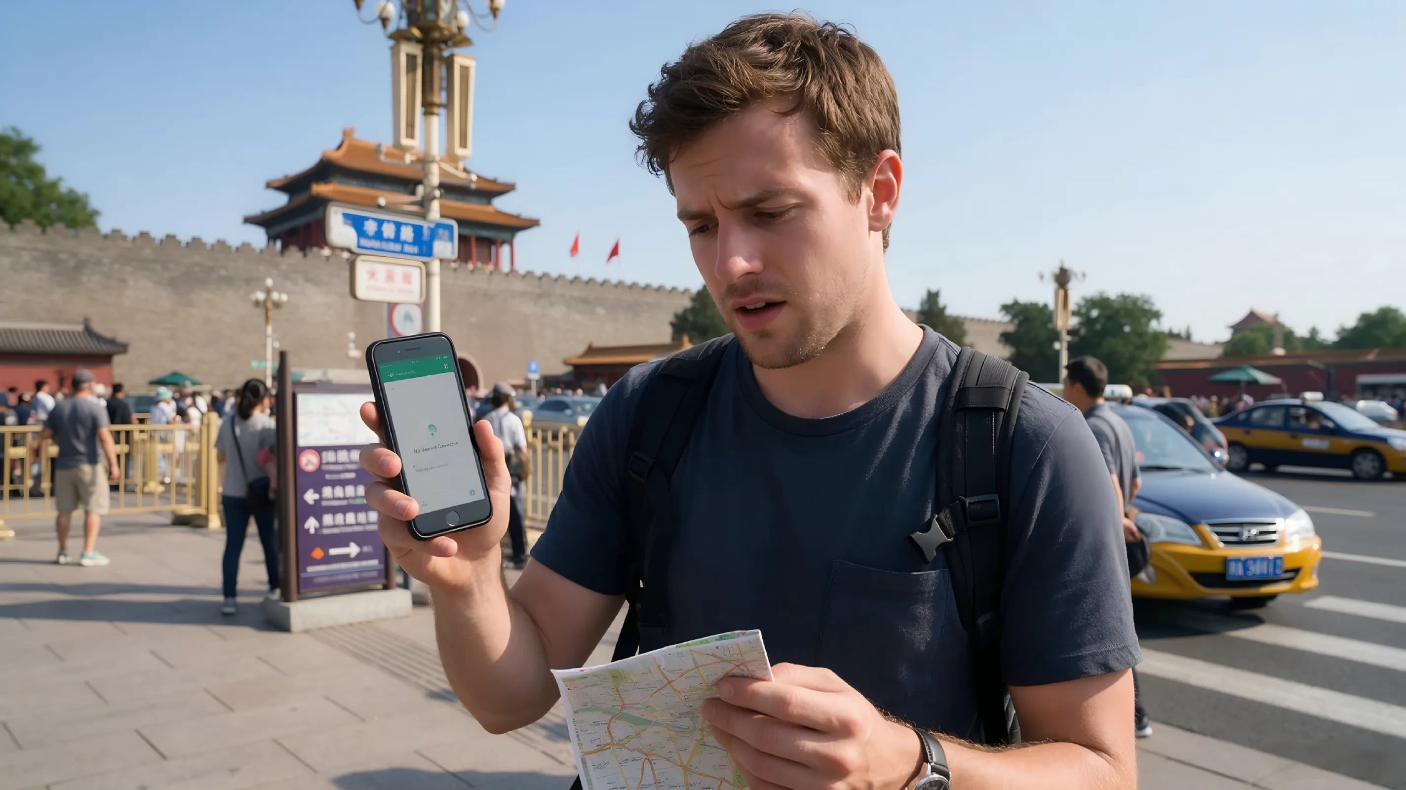
| Navigation | Download offline maps before entering areas with weaker connectivity |
Autumn in the Altai region can feel very different from autumn in lower-elevation cities.
Daytime sunshine can be pleasant, while temperatures can fall quickly after sunset. Mountain weather can also change unexpectedly.
| Item | Why It Matters |
|---|---|
| Warm down jacket | Useful for cold mornings, evenings and sudden temperature drops |
| Windproof outer layer | Helpful in exposed mountain and lakeside areas |
| Non-slip shoes | Useful on wet, uneven or rocky terrain |
| Sun protection | Important because high-altitude sunlight can be strong |
| Power bank | Useful during long driving and photography days |
| Basic emergency supplies | Helpful for long-distance self-driving |
Follow Speed Limits
Long straight roads can create a false sense of security, but drivers should follow posted speed limits throughout the journey.
Some sections may use average-speed enforcement, and road conditions can change quickly around mountain areas.
Watch for Temperature Changes
Cold mornings can produce slippery road surfaces, particularly in shaded mountain sections. If temperatures approach freezing, drive more cautiously and check local road conditions before continuing.
Carry Identification
Some areas of northern Xinjiang are close to international borders and may have checkpoints. Foreign travelers should carry their passports and relevant travel documents and cooperate with identity checks when required.
Do Not Rush to Reach the Next Attraction
The most memorable part of a G331 road trip is often between the major attractions.
Golden forests, river bends, distant mountains and unexpected viewpoints can appear along the road. However, never stop in an unsafe location simply to take a photograph. Use designated parking areas or other safe places to pull over.
| Category | Checklist |
|---|---|
| Vehicle | Fuel, tires, brakes, spare tire and basic emergency equipment |
| Clothing | Down jacket, windproof layer and non-slip shoes |
| Navigation | Online and offline maps with the planned route saved |
| Supplies | Water, snacks and basic medicines |
| Documents | Passport and required travel documents |
| Weather | Check local forecasts before entering mountain areas |
| Fuel | Refuel before entering remote sections |
| Photography | Camera, spare batteries and sufficient storage |
For travelers looking for a practical northern Xinjiang autumn road trip, the following route provides a useful starting point:
Qinghe and Sanhaizi → Fuyun and Koktokay → Irtysh River Valley → Burqin and Habahe → Akeqi National Wetland Park → G331 terminal area
This route gradually changes from highland lakes and grasslands to mountain valleys, forests, river landscapes, wetlands and golden poplar scenery.
The route can be shortened or extended depending on your available time, weather conditions and preferred travel style.
Many famous Xinjiang attractions are destinations in their own right. G331 is different because the journey between them is part of the experience.
You can begin with highland lakes and archaeological landscapes in Qinghe, continue through the dramatic geological scenery of Koktokay, follow the Irtysh River through colorful valleys and eventually reach quieter wetlands and golden forests around Habahe.
The scenery keeps changing because the geography keeps changing.
That is what makes a G331 Xinjiang road trip in autumn more than a simple list of tourist attractions.
What is G331 National Highway?
G331 is a major national highway running across the northern part of China. Official Xinjiang transport planning documents identify it as the Dandong–Altay route and list important Xinjiang nodes including Qinghe, Fuyun and Altay.
When is the best time to see autumn colors in Altay?
Late September to early October is commonly regarded as an important autumn-color period in northern Xinjiang, but the exact timing varies by location, elevation and weather. The peak period can be relatively short, so checking current local conditions before departure is recommended.
Is Koktokay worth visiting in autumn?
Koktokay combines mountain valleys, geological formations, forests, rivers and wetlands, making it particularly suitable for travelers interested in landscape photography and outdoor sightseeing. It is also officially recognized as a national 5A scenic area.
Do I need an SUV for a G331 road trip?
A normal passenger car can be suitable for many sections of the main route under normal road conditions. An SUV or vehicle with higher ground clearance can be more practical for certain secondary roads leading to remote scenic areas. Always check current road conditions before taking a side route.
What should I wear in Altay during autumn?
Prepare for large temperature differences. A warm down jacket, windproof outer layer and comfortable non-slip shoes are recommended, especially if you plan to visit mountain areas early in the morning or stay outdoors after sunset.
Is G331 suitable for foreign tourists?
Yes, the route can be suitable for international travelers who are comfortable with long-distance road trips. However, the distances are substantial, services can become less frequent in remote areas, and some border-area sections may involve identity checks. Carry your passport and travel documents and allow additional time for checkpoints when necessary.
An autumn journey through northern Xinjiang is not simply about finding one perfect viewpoint.
It is about watching the landscape transform as the road climbs, descends, follows a river or crosses an open valley.
Along G331, the autumn journey can take you from the highland landscapes of Qinghe to the geological wonders of Koktokay, from the Irtysh River valleys to the wetlands and golden forests around Habahe.
If you are planning a Xinjiang autumn road trip, the G331 corridor offers an unusually varied way to experience the Altay region. Give yourself enough time, prepare for rapidly changing weather, keep your fuel tank comfortably full and leave room in your itinerary for the scenery between the destinations.
In autumn, the road through the Altai region is not simply a way to reach the next attraction. The road itself becomes part of the journey.
Your journey, simplified
How We Work
From the first idea to the final day, every detail is handled with care.
Share your travel ideas
Tell us where you want to go and what you enjoy.
Meet your travel advisor
We shape a personal itinerary around your priorities.
Confirm your journey
Review every detail and reserve with confidence.
Travel with support
Our team stays available throughout your trip.
Travel expert
Contact Your Travel Specialist
Get practical advice from a local specialist and turn this route into a trip that fits you.
Start planningRelated Articles
Swipe to explore