Xinjiang Self-Driving Tour 2026: 10 Road Trip Routes for an Epic China Adventure
10 Road Trip Routes for an Epic China AdventureXinjiang is one of the best regions in China for travelers who want to experience a destination by road rather than simply moving from one tourist attrac
Xinjiang is one of the best regions in China for travelers who want to experience a destination by road rather than simply moving from one tourist attraction to another.
The landscape changes dramatically across the region. A single road trip can take you from snow-covered mountains and alpine grasslands to deserts, river valleys, forests, lakes, wetlands and historic settlements.
For travelers planning a Xinjiang self-driving tour in 2026, the road network is also becoming more convenient. New and upgraded highways are making it easier to connect northern and southern Xinjiang, while dedicated tourism roads are creating slower scenic routes around lakes, grasslands and mountain valleys.

This guide introduces 10 Xinjiang road trip routes for 2026, ranging from major expressways to scenic regional roads and a genuine desert adventure route. Each route has a different character, so the right choice depends on whether you prefer fast transportation, landscape photography, cultural exploration, family travel or off-road adventure.
Xinjiang is geographically enormous, and distances between destinations can be substantial. Driving gives travelers more control over where to stop, how long to stay and which landscapes to explore.
The development of new roads is also changing the way visitors can plan their itineraries. The G0711 Urumqi–Yuli Expressway, for example, opened at the end of 2025 and entered trial operation in January 2026. The 324.7-kilometer expressway includes the 22.13-kilometer Tianshan Shengli Tunnel, officially described by the Xinjiang transport authority as the world's longest highway tunnel.
At the same time, tourism roads such as the G331 northern border corridor, the Sayram Lake–Wenquan route and the Bosteng Lake loop provide opportunities to slow down and focus on scenery rather than simply reducing driving time.
| Route | Main Landscape | Recommended For | Vehicle |
|---|---|---|---|
| G0711 Urumqi–Yuli Expressway | Mountain, tunnel, oasis and desert | Cross-region travel | Normal passenger car |
| G331 Qinghe–Fuyun–Altay | Grassland, forest, river and lakes | Northern Xinjiang road trips | Passenger car, SUV for side roads |
| G577 Jinghe–Yining Corridor | Gobi, mountain and grassland | Ili Valley itineraries | Normal passenger car |
| S340 Luntai–Hongqi Ranch | Desert, mountain and grassland | Mountain scenery | Passenger car when conditions permit |
| Bosteng Lake Loop | Lake, desert, wetlands and grassland | Slow travel and families | Passenger car |
| G7 Wutong Daqing–Mulei | Gobi, desert, grassland and lakes | Eastern Xinjiang road trips | Normal passenger car |
| G580 Desert Silk Road | Desert, poplar forest and oasis | Southern Xinjiang exploration | Passenger car on paved sections |
| S321 Huoshao Bridge–Bayinbuluke | River, forest and alpine grassland | Grassland scenery | Passenger car |
| S222 Wenquan–Sayram Lake | Wetlands, forest, grassland and alpine lake | Northern Xinjiang scenery | Normal passenger car |
| Hami Danxia Desert Route | Yardang, desert and remote wilderness | Off-road adventure | 4WD recommended on unpaved sections |
The G0711 Urumqi–Yuli Expressway is one of the most important additions to Xinjiang's road network for travelers planning a 2026 road trip.
The route runs for approximately 324.7 kilometers between the Urumqi area and Yuli County. It passes through the Tianshan Mountains and connects northern and southern Xinjiang transportation networks.

Its most remarkable engineering feature is the 22.13-kilometer Tianshan Shengli Tunnel. The Xinjiang transport authority states that the tunnel is the world's longest highway tunnel. The tunnel reduces the time required to cross the Tianshan Mountains from several hours to approximately 20 minutes.
What Makes This Route Special
The most interesting aspect for travelers is the rapid change in landscape.
On one side of the Tianshan Mountains are the greener landscapes associated with northern Xinjiang. After passing through the long tunnel, the scenery changes toward the drier landscapes, oases and deserts of southern Xinjiang.
This makes G0711 particularly useful for travelers who want to combine northern and southern Xinjiang in one itinerary without spending an entire day crossing the mountains by road.
Places to Combine with G0711
Depending on your itinerary, the route can be combined with destinations around Urumqi, Baluntai, Hejing, Korla and Yuli.
Travelers interested in history and culture can also explore nearby heritage sites and historic landscapes rather than treating the expressway simply as a transportation corridor.
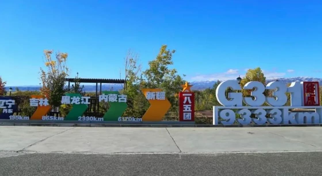
The G331 corridor is one of the most distinctive road-trip routes in northern Xinjiang.
The official national highway planning information identifies G331 as the Dandong–Altay route and lists major Xinjiang nodes including Takshiken, Qinghe, Fuyun, Altay, Burqin and Habahe.

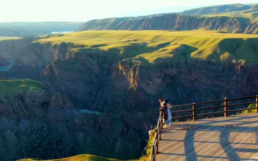
The Xinjiang section combines Gobi landscapes, river valleys, forests, grasslands, lakes and wetlands. Instead of one single landmark, the attraction is the continuous change in scenery.
Qinghe and Sanhaizi
Qinghe provides access to highland lakes, grasslands and archaeological landscapes.
The Sanhaizi area is particularly interesting for travelers who want to combine natural scenery with the ancient cultural landscape of the northern steppe.
Fuyun and Koktokay
Further west, Fuyun and Koktokay offer mountain valleys, geological formations, forests and river scenery.
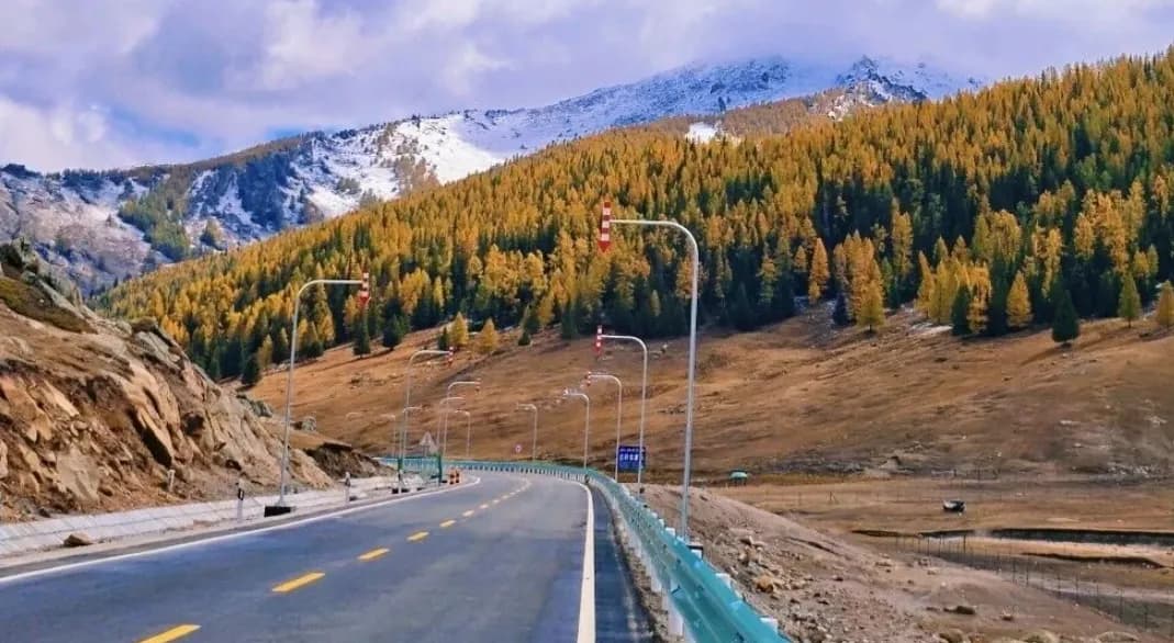
Autumn is especially attractive here, when forests and grasslands create strong contrasts with the surrounding mountains.
Altay and the Irtysh River Valley
Following the route toward Altay brings travelers into landscapes shaped by the Irtysh River, forests and open valleys.
For photographers, this section can be particularly rewarding in autumn, when golden vegetation contrasts with blue water and darker mountain slopes.
The G577 Jinghe–Yining road is another important transportation project for travelers heading toward the Ili Valley.
The route is approximately 92.545 kilometers long and connects with the G30 Lianhuo Expressway near Jinghe. It continues toward Nileke County and connects with the wider regional road network. Official transport information describes the project as a four-lane first-class highway with a design speed of 100 kilometers per hour.

The route includes a major 11.896-kilometer northern Tianshan tunnel. Official project information highlights its role in improving year-round access to the Ili Valley.
Why Add G577 to an Ili Road Trip?
The main value of this route is connectivity.
Instead of treating the road as the destination itself, travelers can use it to create a larger Ili itinerary that includes grasslands, forests, mountain valleys and cultural attractions.
Possible extensions include Tohulasu Grassland, Tangbula Grassland and other destinations around Nileke and the wider Ili region.
The S340 Luntai–Hongqi Ranch road is designed to connect the northern edge of the Tarim Basin with the Bayinbuluke grassland area.
The project is approximately 127 kilometers long and includes the 8.5-kilometer Wulei Tunnel. According to the Xinjiang transport authority, the route is expected to significantly reduce travel time between Luntai and Bayinbuluke after opening.

This route is especially interesting because of the dramatic change in landscape.
The Southern Section
The southern part of the route is characterized by the dry landscapes of the Tarim Basin, including desert vegetation and poplar forests.
The Tianshan Section
The road then enters the Tianshan Mountains through the Wulei Tunnel.
After leaving the tunnel, the environment changes toward forests, snow-covered peaks, river valleys and highland pasture.
The Bayinbuluke Section
The northern end connects with the Bayinbuluke area, one of the best-known grassland landscapes in Xinjiang.
However, travelers should verify the actual operating status of the route before planning a trip around it. Construction and opening schedules for major mountain roads can change because of weather, engineering and safety requirements.
The Bosteng Lake tourism road provides a very different experience from the major mountain highways.
The loop is approximately 239 kilometers long and passes through Bosteng Lake County, Heshuo County and surrounding areas. It connects attractions including Dahekou, Lianhai World, Bailuzhou and Jinshatan.

The route officially opened in September 2024 and has been promoted as a tourism road combining lake, desert, Gobi and wetland landscapes. The Xinjiang transport authority reported that the route is approximately 239.2 kilometers long and forms a distinctive landscape corridor where lake scenery and desert landscapes appear alongside each other.
What to See Around Bosteng Lake
Travelers can expect reeds, wetlands, open water, sandy landscapes and wide horizons.
The route is also suitable for slower travel because there are multiple scenic areas, restaurants and accommodation options along the broader tourism corridor.
Who Should Choose This Route?
The Bosteng Lake loop is particularly suitable for families, photographers and travelers who do not want every day of a Xinjiang road trip to involve long-distance driving.
The G7 Beijing–Urumqi Expressway is one of the major transportation corridors connecting Xinjiang with eastern China.
The Wutong Daqing–Mulei section provides access to some of eastern Xinjiang's most distinctive landscapes, including desert, Gobi, grassland, lakes and poplar forests.

Major Stops Along the Route
Travelers can use this corridor to connect destinations such as the Yiwugobi landscape, Hami poplar forests, Balikun Grassland and Jiangbulake.
The scenery changes from extremely dry desert and Gobi landscapes to greener grassland and mountain environments.
What Makes Eastern Xinjiang Different?
Eastern Xinjiang often feels more spacious and arid than the Ili Valley or Altay region.
For photographers, the combination of empty roads, enormous skies, desert textures and distant mountains can create a very different visual experience from northern Xinjiang's forests and lakes.
The G580 corridor provides an opportunity to explore the southern Xinjiang desert landscape while connecting areas around Alar, Awati and Hotan.
The route crosses the broader Tarim Basin environment and connects desert scenery with oases, historic landscapes and local communities.

Desert Landscapes and Poplar Forests
In autumn, golden poplar forests can create a striking contrast with the surrounding desert.
This is one of the most visually distinctive combinations in southern Xinjiang: bright autumn foliage surrounded by vast dry landscapes.
What to Expect on a Desert Road Trip
Long distances, strong sunlight and limited services in some sections mean that preparation is particularly important.
Carry sufficient drinking water, keep your fuel tank well above empty and check road and weather conditions before entering remote areas.
The S321 section between Huoshao Bridge and Bayinbuluke provides another way to experience the central Tianshan landscape.
The road follows the Kaidu River and connects the forested landscapes around Gongnaisi with the open grasslands of Bayinbuluke.

Kaidu River and Grassland Scenery
The Kaidu River winds through the grassland like a silver ribbon. Water, pasture and mountain scenery create a landscape that changes throughout the day as the light moves across the valley.
Bayinbuluke Wetlands and Swan Lake
The wider Bayinbuluke area is known for its wetlands, grasslands and bird habitats. Swan Lake National Nature Reserve is one of the major natural attractions in the region.
Travelers interested in wildlife and landscape photography should allow more time here rather than treating the area as a simple pass-through point.
The S222 Wenquan–Sayram Lake route is a relatively short tourism road but connects several very different landscapes.
The road is approximately 61.3 kilometers long and was formally incorporated into the provincial road network in 2026. It connects the Wenquan area with Sayram Lake and links with the G30 Lianhuo Expressway near the lake.

Wenquan Wetlands and Forests
The northern section passes through wetland and river-valley landscapes, while forested areas add another layer of scenery.
Sayram Lake
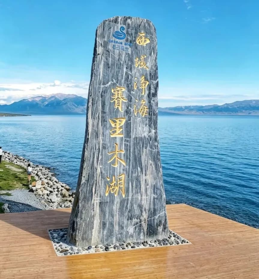
The route eventually reaches Sayram Lake, one of the best-known alpine lakes in Xinjiang.
The transition from wetlands and forests to a high-altitude lake makes this a compact route for travelers who want to experience several northern Xinjiang landscapes without committing to a multi-day drive.
For travelers looking for something more adventurous, the Hami Danxia Desert route offers a very different driving experience.
The route through the Danxia and desert landscape includes yardang formations, historic ruins, fossil-related sites and remote desert scenery.
Unlike the major highways in this guide, some sections are unpaved and more suitable for experienced drivers and four-wheel-drive vehicles.

Paved and Unpaved Sections
The approximately 76-kilometer scenic road section is paved and can be accessible to ordinary passenger vehicles under suitable conditions.
Further sections toward the northern exit include unpaved gravel and sandy terrain. These sections require considerably more preparation and should not be treated like a normal highway drive.
Who Should Attempt the Remote Sections?
Drivers should have experience with remote-area travel, understand their vehicle's capabilities and check the latest local access conditions before departure.
For inexperienced drivers, joining an organized expedition or using a professional local guide can be a safer way to experience remote desert terrain.
The best route depends heavily on your travel goals.
| If You Want | Consider |
|---|---|
| Fast north-south travel | G0711 Urumqi–Yuli Expressway |
| Altay autumn scenery | G331 Qinghe–Fuyun–Altay |
| Ili Valley access | G577 Jinghe–Yining corridor |
| Mountain scenery and grassland | S340 or S321 |
| Lake and desert landscapes | Bosteng Lake Loop |
| Eastern Xinjiang desert scenery | G7 corridor |
| Southern Xinjiang desert travel | G580 corridor |
| Alpine lake scenery | S222 Wenquan–Sayram Lake |
| Off-road adventure | Hami Danxia Desert route |
Xinjiang is too large to experience properly by trying to cover everything in one trip.
A better approach is to choose one geographical region and build a route around it.
| Trip Length | Possible Strategy |
|---|---|
| 3–4 days | Choose one compact route such as Sayram Lake and Wenquan |
| 5–7 days | Focus on one major region such as Altay, Ili or eastern Xinjiang |
| 8–12 days | Combine several connected scenic corridors |
| Two weeks or more | Consider a larger northern or north-south Xinjiang road trip |
The key is to avoid calculating your itinerary purely from driving distance. Scenic stops, photography, meals, weather and unexpected road conditions can easily add several hours to a travel day.
You do not necessarily need an SUV for a Xinjiang road trip.
Major expressways and paved tourism roads can generally be traveled by ordinary passenger vehicles when road and weather conditions are suitable.
The situation changes when you leave the main road.
| Road Type | Typical Vehicle Consideration |
|---|---|
| Expressways | Normal passenger car |
| Paved tourism roads | Normal passenger car in suitable conditions |
| Mountain side roads | Higher ground clearance may be useful |
| Remote gravel roads | SUV recommended |
| Deep sand and desert tracks | Four-wheel drive and appropriate experience required |
Never assume that a road is suitable for your vehicle simply because it appears on a digital map. Check local road conditions before entering remote sections.
Distances can be deceptive in Xinjiang. A road may appear straightforward on a map while the next fuel station or restaurant is still far away.
Fuel
Refuel whenever you reach a major town, particularly before entering mountain or desert areas.
Food and Water
Keep drinking water and basic snacks in the vehicle. This is especially important when visiting remote scenic areas where services may be limited.
Mobile Connectivity
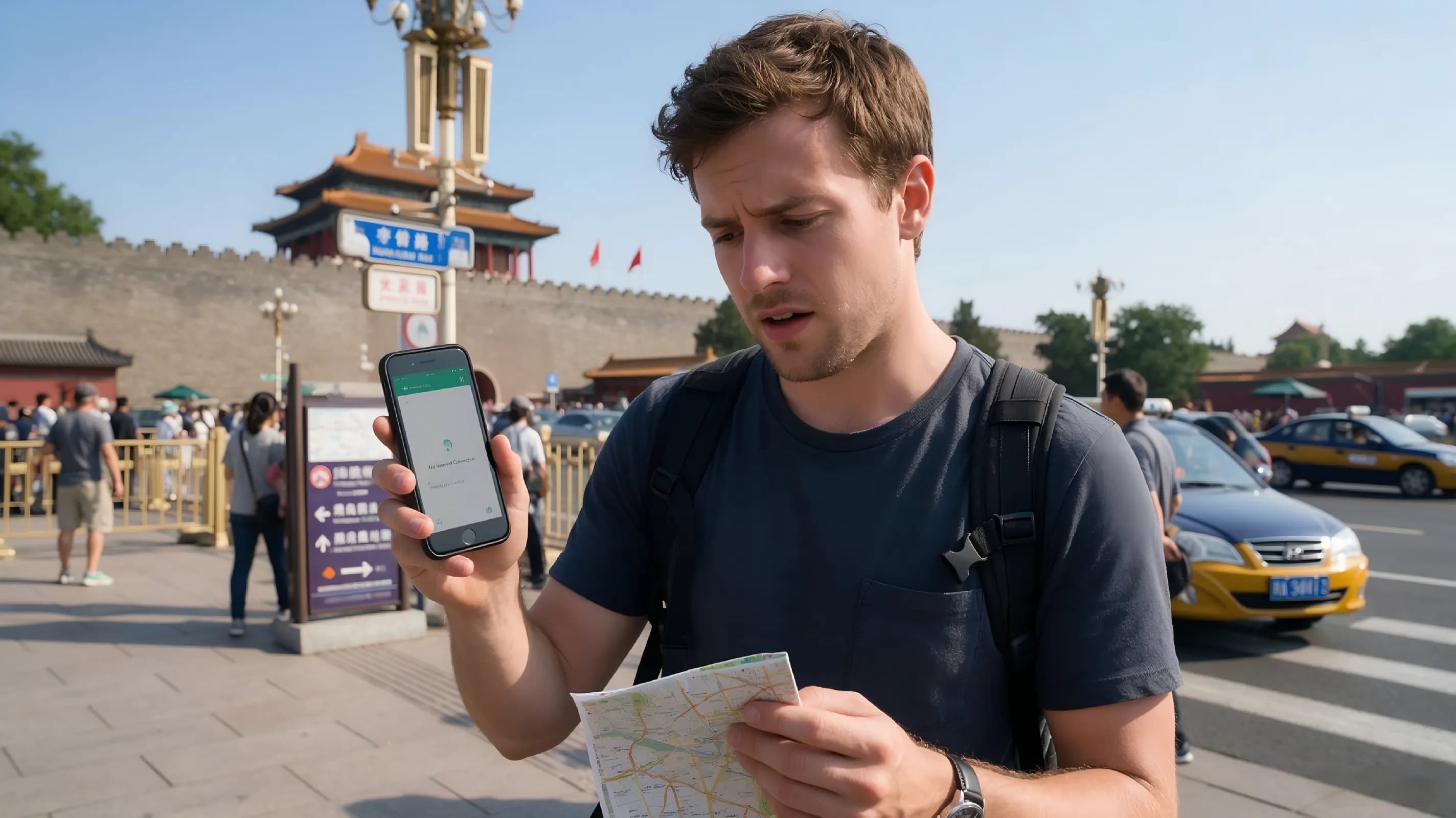
Download offline maps and save important locations before leaving major towns. Connectivity can be weaker in remote mountains and desert areas.
Check the Weather Before Every Long Drive
Xinjiang has enormous geographical variation. Weather conditions can change quickly in mountain areas, while desert regions can experience strong winds and blowing sand.
Be Careful with Night Driving
Long-distance night driving is not ideal on unfamiliar mountain or remote desert roads. Wildlife, poor visibility, weather and unexpected road conditions can increase driving risks.
Respect Speed Limits
Do not let the long straight roads encourage excessive speed. Some roads use fixed speed enforcement or average-speed monitoring.
Carry Identification Documents
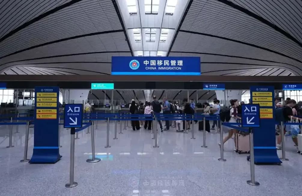
Some parts of Xinjiang are close to international borders and may contain checkpoints. International travelers should carry their passports and relevant travel documents and allow additional time when passing through checkpoints.
Check Seasonal Road Access
A road that is open in summer may have different operating conditions in winter or during severe weather.
This is especially important for high-altitude mountain routes. Always confirm current road status before departure.
| Item | Why You Need It |
|---|---|
| Warm layers | Temperatures can change significantly between day and night |
| Windproof jacket | Useful in exposed mountain, grassland and desert areas |
| Comfortable walking shoes | Useful for scenic areas and uneven ground |
| Sun protection | Important under strong high-altitude sunlight |
| Drinking water | Essential for long-distance driving |
| Power bank | Useful for navigation and photography |
| Offline maps | Helpful when mobile connectivity becomes unreliable |
| Emergency supplies | Useful during long or remote driving sections |
International travelers should think about the trip in several stages rather than booking everything at once.
Choose Your Region First
Decide whether you want to focus on northern Xinjiang, the Ili Valley, Altay, eastern Xinjiang or southern Xinjiang.
Build the Route Around Driving Time
After choosing the region, calculate realistic driving times between overnight stops. Avoid creating an itinerary that requires six or seven hours of driving every day.
Reserve Accommodation in Popular Seasons
Autumn in Altay and summer in the Ili Valley can be busy. Accommodation in popular scenic areas can become limited during peak periods.
Verify Road Conditions Before Departure
Road construction, weather and seasonal restrictions can change. Check official transport information and local scenic-area announcements shortly before starting each major section.
| Travel Style | Route Ideas |
|---|---|
| First-time Xinjiang visitor | G0711 combined with northern or southern Xinjiang attractions |
| Autumn photographer | G331 and the Altay region |
| Grassland traveler | G577, S321 and the Ili region |
| Lake lover | S222 and the Bosteng Lake Loop |
| Desert enthusiast | G7, G580 and the Hami desert routes |
| Adventure traveler | Remote desert routes with suitable vehicles and local support |
| Family road trip | Bosteng Lake and other routes with shorter driving sections |
Is Xinjiang suitable for a self-driving trip in 2026?
Yes. Xinjiang has an extensive network of expressways, national highways, provincial roads and tourism roads. New infrastructure is also improving connections between major regions. The G0711 Urumqi–Yuli Expressway entered trial operation in 2026, while other major road projects continue to expand regional connectivity.
What is the most scenic road trip in Xinjiang?
There is no single route that fits every traveler. G331 is particularly suited to Altay landscapes and autumn scenery, while S222 focuses on the transition from wetlands and forests to Sayram Lake. Bosteng Lake is better suited to slower lake-and-desert travel, while the Hami desert route offers a more remote adventure experience.
Can foreigners drive in Xinjiang?
International visitors need to meet China's legal requirements for driving and vehicle rental. Before planning a self-drive itinerary, confirm whether your license, driving permit, insurance and rental arrangements are accepted by the relevant vehicle rental company and local authorities.
Do I need an SUV to travel around Xinjiang?
Not for most major highways and paved tourism roads. A normal passenger car can be sufficient for many routes. An SUV becomes more useful when your itinerary includes gravel roads, mountain side roads or remote desert terrain.
What is the best season for a Xinjiang road trip?
The best season depends on the route. Summer is popular for grasslands and alpine lakes, autumn is particularly attractive for Altay forests and golden vegetation, while spring is suitable for some flower-viewing routes. Winter can provide snow and ice landscapes but requires much more careful planning around road and weather conditions.
How should I prepare for long-distance driving in Xinjiang?
Plan fuel stops in advance, carry water and snacks, download offline maps, check weather and road conditions, and avoid overloading each day with driving. A flexible itinerary is particularly useful because Xinjiang's distances and weather can make actual travel times different from map estimates.
A Xinjiang self-driving tour in 2026 is no longer limited to a handful of famous roads.
New expressways make long-distance travel faster, while tourism roads provide more opportunities to slow down and explore landscapes at your own pace.
G0711 offers a remarkable way to cross the Tianshan Mountains. G331 opens a long northern corridor through Altay. G577 improves access to the Ili Valley. S340 connects desert landscapes with highland grasslands. The Bosteng Lake loop combines water, wetlands and desert, while G7 and G580 reveal the enormous scale of eastern and southern Xinjiang.
The important thing is not to try to drive all ten routes in one trip.
Choose one region, give yourself enough time, check the latest road conditions and leave space for the unexpected views that appear between the destinations.
In Xinjiang, the road is often more than a way to reach the attraction. The road itself is part of the journey.
Your journey, simplified
How We Work
From the first idea to the final day, every detail is handled with care.
Share your travel ideas
Tell us where you want to go and what you enjoy.
Meet your travel advisor
We shape a personal itinerary around your priorities.
Confirm your journey
Review every detail and reserve with confidence.
Travel with support
Our team stays available throughout your trip.
Travel expert
Contact Your Travel Specialist
Get practical advice from a local specialist and turn this route into a trip that fits you.
Start planningRelated Articles
Swipe to explore